


- Home /
- All Equipment /
- Used Equipment for Sale /
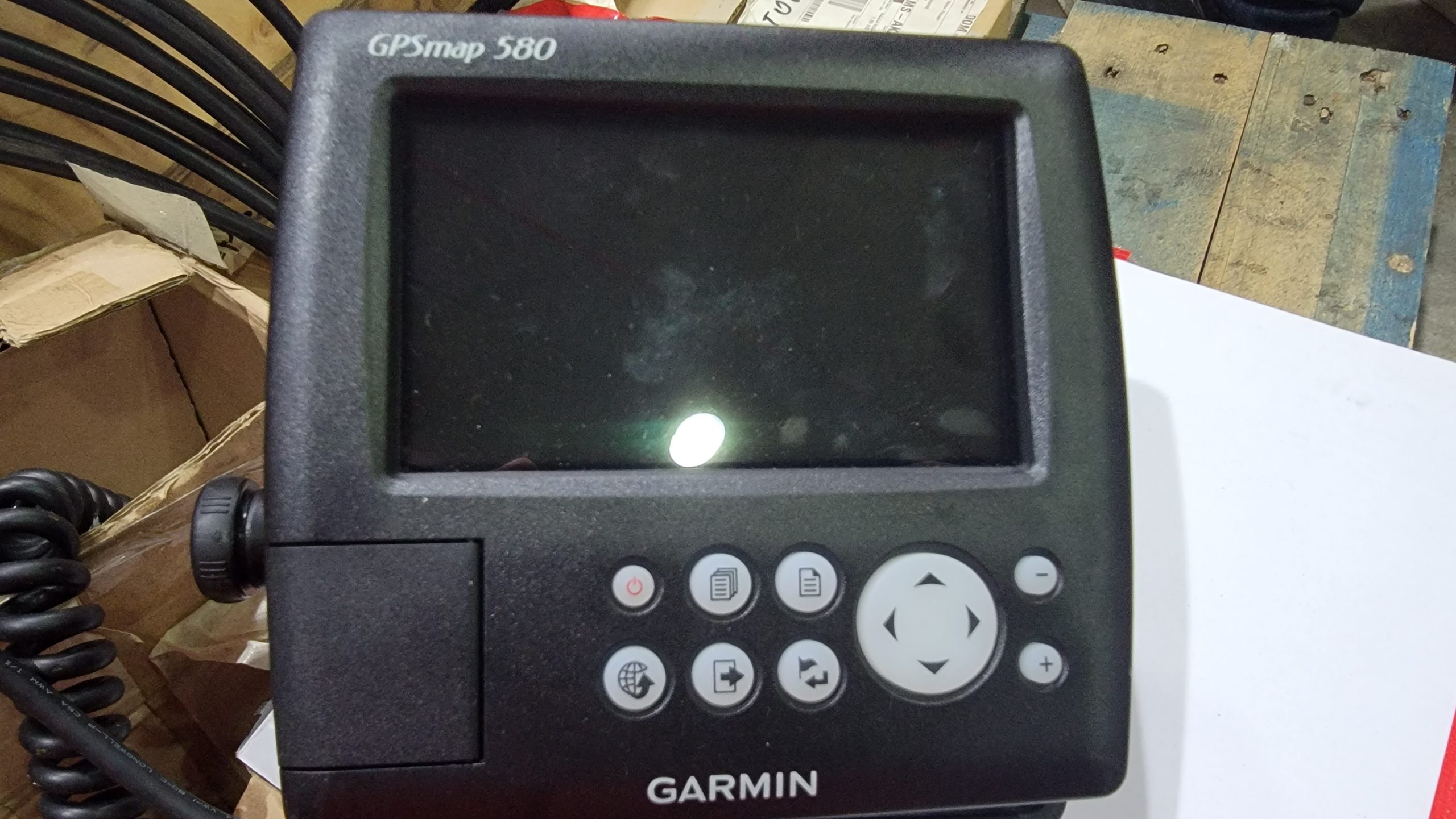
- GARMIN GPS MAP 580 Fishing Navigation Satellite Navigation Device Waterproof High Accuracy
GARMIN GPS MAP 580 Fishing Navigation Satellite Navigation Device Waterproof High Accuracy
- Available For: Sale|
- Listed on: 03-Mar-2024
- | Functions: Marine Equipment, Parts & Accessories
- | Type: Machinery
- | Price: S$ 540
- Manufacturer: GARMIN
- Model: GPS MAP 580
- Condition: USED
- Available for Export
Product Details:
Physical dimensions 5.9" x 6.4" x 2.9" (15.0 x 16.3 x 7.4 cm)
Display resolution 480x272 pixels
Display type WQVGA
Weight 390g
Waterproof: yes (IPX7)
Basemap: Yes
Waypoints/favorites/locations: 6000
Routes: 150 tracks/250 points
The GPSMAP 580 is a full-function chart plotter that features an ultra-bright 5” WQVGA color display along with an improved feature of high-speed map drawing and panning. It’s ready to go with an easy-to-use interface and a built-in worldwide basemap. The 580 is unique Garmin chart plotters that not only equip with English language but also with Asian languages including Simplified Chinese and Bahasa Indonesia. GPSMAP 580 is designed specifically for professional fishermen and comes with the advantages of Garmin’s renowned GPS168/178C chart plotters.
Explore the Seas
The GPSMAP 580 comes standard with a built-in high-sensitivity GPS module for superior satellite tracking and quicker acquisition times. And with a SD card slot, it’s easy to add additional maps without connecting to a computer
GARMIN GPS MAP 580 Fishing Navigation Satellite Navigation Device Waterproof High Accuracy
Categories: All Equipment, Used Equipment for Sale
Tag: ESG Maritime Enterprises Pte Ltd
Seller Info
ESG Maritime Enterprises Pte Ltd
- 7500A Beach Road, #09-315 The Plaza, Singapore 199591
- +65 8030 3173
- technical@esgtech.com.sg
- Listed items (10)
Filter Element
S$ 30
i.Safe 910.1 Atex Tablet Zone 1/21
S$ 3,250
IRIDIUM 9555 Satellite Phone
S$ 986
Small Sized Liquid Storage Tank
S$ 1,644
520N-08 1/2
S$ 700
520N-04 1/4
S$ 450
CARRIER 5H-126 Aircon Compressor
S$ 16,000
COFFIN DEB 16 Boiler Feed Pump
S$ 12,000
IHI RH163 Turbocharger Complete
S$ 8,600
DAIHATSU 6DKb-20 Camshaft
S$ 4,800
WARTSILA L20 Piston Crown
S$ 1,800
WARTSILA L20 Fuel Nozzle
S$ 160
YANMAR EY22ALW Cylinder Cover
S$ 3,200
MITSUBISHI SJ 20T Purifier c/w Motor
S$ 11,000
WESTFALIA Purifier c/w Motor
S$ 13,800
Heater for FWG Evaporator 30M3/day
S$ 13,600
Tank Cleaning Heater, 60m2
S$ 12,000
AZCUE LN50/315 Pump c/w Motor
S$ 15,000
Daihatsu 8VSHTb-26D Crankshaft
S$ 28,000
SULZER RTA72U Main Bearing Shell
S$ 4,200
Radiator Tower, Motor Fan Driven
S$ 6,500
DAIKIN 8C75EB Air-Con Compressor
S$ 15,000
TANABE H273 Main Air Compressor
S$ 23,000
TANABE H73 Topping Up Air Compressor
S$ 14,700
Laser Shaft Alignment
S$ 7,000
CUMMINS NTA 855
S$ 4,100
Super Rack Container
S$ 4,900
Drilling/ Milling Machine
S$ 750
Direction Control Valve
S$ 1,500
SOILMEC SR-60 Hydraulic Drilling Rig
S$ 280,000
Pneumatic Driven Hydraulic Pump
S$ 1,000
Pneumatic Driven Hydraulic Pump
S$ 1,500
Fuel Valve Testing Device
S$ 800
TORQUE Wrench - 3 Sizes
S$ 80
1 Ton Water Storage Tank
S$ 165
Corrosive/ Acid Steel Safety Cabinet
S$ 1,000
Spill Pallet
S$ 180
Marine Stabilized Tx/ Rx System
S$ 34,200
Hydraulic Ironworker
S$ 6,000
5T Air Winch
S$ 38,000
50T Plimsoll Winch
S$ 120,000
10T Air Winch
S$ 65,000
7T Air Winch
S$ 50,000
6.5T Air Winch
S$ 40,000
4T Air Winch
S$ 35,000
2.5T Air Winch
S$ 20,000
35T Double Drum Winch
S$ 75,000
1000T Wire Block
S$ 280,000
Swivel Fairleader
S$ 15,000
Subscribe to Product Alert